
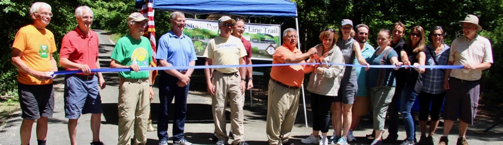


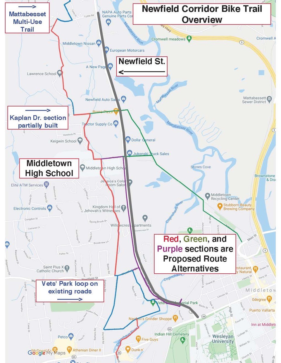
 A study to determine the best route for the Newfield Corridor Trail is underway. Design and construction of the trail was funded by the 2015 Parks Bond, and assigned a budget of $4 million. This multi-use bikeway will be an extension of the Mattabesset Bike Trail southward from Tuttle Road to Veterans Park. (To access a Google Map of the Newfield Corridor Trail options that you can zoom in on to see details, click here.)
Design and Construction of Northern Section
The first, northernmost segment from Tuttle Road to Mile Lane is the most straightforward section. It will provide a safe option for children living in the Westlake area to bicycle to Lawrence School. However, unforeseen complications–an archaeological survey and a land swap between the City and a developer–have delayed work on this section for at least one year. The section from Mile Lane to Middletown High School will be laid out next. Design and construction of these two sections will cost at least $1 million.
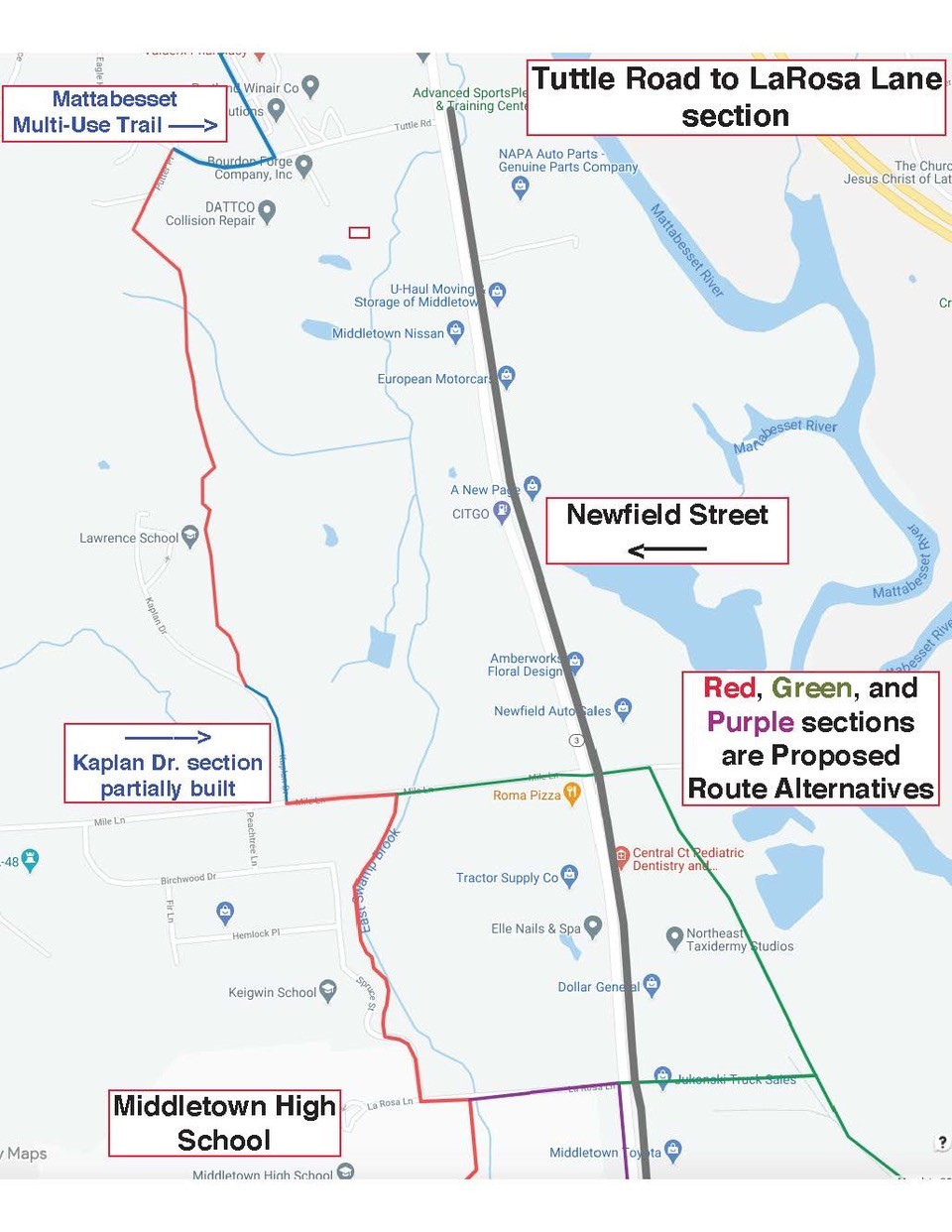 The route from Middletown High School (LaRosa Lane) to Westfield Street is more complicated. (See map below.)
Middletown’s Public Works Commission originally asked Milone and MacBroom to explore a route following the East Swamp Brook wetland. A multi-use trail through this area would be very scenic and appealing to bicyclists, but it would require construction of a boardwalk trail. Not only would that be very expensive (perhaps $3 million or more) but it would entail disruption and destruction of considerable wetlands and wildlife habitat. Wetlands in this area were already damaged by the construction of Middletown High School.
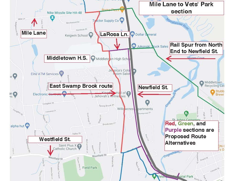
This map shows the 2 options available between LaRosa Lane and Westfield Street.
Another option for the LaRosa Lane to Westfield Street segment involves a multi-use trail along adjacent to Newfield Street, or buffered bike lanes along Newfield Street. The Jonah Center recommends study of this option as part of the Air Line Trail – Farmington Canal Connector Route study, even though such a route would cross numerous intersecting driveways. The fact that the CT DOT has already identified Newfield Street as a state highway in need of safety and access improvement for bicycles may help the City obtain CT DOT assistance with construction along this route.
Note also on the map above the route labeled “Rail Spur from North End to Newfield Street.” A multi-use trail following this route would constitute a section of the 23-mile Air Line Trail – Farmington Canal Connector, part of the larger Central CT Loop Trail being promoted by the Jonah Center.