


Portland to East Hampton Developments
There is a major development happening with the Air Line Trail in Portland and East Hampton Connecticut. Users of the trail will be glad to know that significant progress is being made to connect the Portland and East Hampton sections of the trail and thereby connect the Portland trail to the rest of the 55-mile long Connecticut State Park Air Line Trail. This has been a long-term goal of the two towns and the State Parks Division.
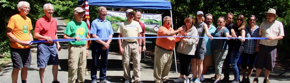
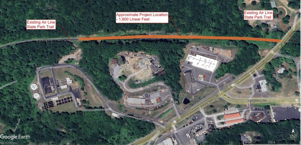
June 3 marks the 7-year anniversary of the ribbon-cutting ceremony celebrating the opening of the Air Line Trail in Portland in 2018. A few months later, East Hampton completed a section of their trail connecting it to Portland’s. However, a small 1800-foot gap remained in East Hampton separating the two segments. This gap has frustrated many users of the trail for the past 6 years.
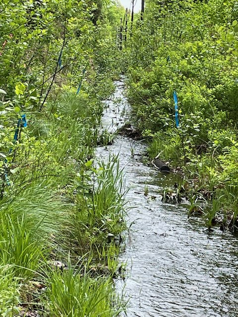
The 1800-foot gap was unable to be completed as part of the original plan because a stream ran through it and it was designated as wetlands, requiring a wetlands study. A plan then needed to be developed to allow the trail through without disturbing the stream and water way and appropriate permits obtained. Eversource also had power lines running through this section that further complicated the situation. Sufficient funding also needed to be found. This all took several years to work out.
But at a recent public meeting in East Hampton held on May 6, the town announced that the Wetlands Study had been completed; an agreement was reached with Eversource; a design plan has been developed to complete the gap; and funding is in place.
The plan is to construct an elevated 1400-foot boardwalk above the wetlands section that will allow trail users to cross through without disturbing the stream. The estimated cost of the gap/boardwalk project is $2,256,000 and will be shared between federal, state, and local sources.
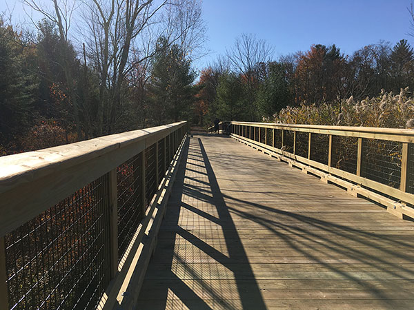
East Hampton town officials hope to finalize the plan and obtain all necessary permits by the end of 2025. If all goes according to plan, construction will begin in 2026 and take 6-9 months to complete.
Credit to Shawn Mullen, East Hampton Recreation Director; David Cox, Town Manager; and Kevin Grindle, Landscape Architect for Barton and Loguidice for their work on this project.
More details about the East Hampton gap plan may be found here.
Portland to Middletown Progress
At the other end of the trail in Portland the goal is to continue the trail from its current termination point near YMCA Camp Ingersoll to the Arrigoni Bridge and the City of Middletown. While multiple plans have been developed over the past 7 years to accomplish this goal, progress has been slow because the original Air Line Trail route is owned by several different private property owners – a situation unique to Portland as far as the Air Line Trail goes. This means separate agreements need to be reached with each property owner or alternate routes need to be found.
Fortunately, most of the properties along the original trail route are undeveloped and most of the property owners are agreeable to work out deals with the town for their use. But finalizing these agreements has not been an easy task and is still in progress. Town officials are hopeful that agreements on the first stage of this extension will be reached soon so the trail can at least be extended to routes 17 and 66 near Dairy Queen.
Credit to the Town of Portland’s Air Line Trail Steering Committee and co-chairs, Riz Rizzo and Lou Pear as well as first Selectmen Susan Bransfield, Ryan Curley, and Mike Pelton for their efforts with this challenging task.
In the meantime, the Lower Connecticut River Valley Council of Governments recently completed an extensive feasibility study designed to link the Air Line Trail to the Farmington-Canal Heritage Trail through a 23-mile connector trail. This route would run from Portland through Middletown and Meriden and form a 111-mile Central Connecticut Loop Trail that would link to the East Coast Greenway. While this is a large-scale, long-term project, there is growing interest from around the state to pursue it. And the goal of extending the Portland Air Line Trail to Middletown would be essential and serve a much greater purpose than just benefiting Portland and Middletown residents.
For more information regarding the Central Connecticut Loop Study, see here.